Landscape Of The Mountains In Merida Venezuela Pictures, Images and Stock Photos
Browse 280+ landscape of the mountains in merida venezuela stock photos and images available, or start a new search to explore more stock photos and images.
Most popular
altiplano,andes,beauty in nature,cloud - sky,cold temperature,endemic - species,extreme terrain,high up,land,landscape - scenery,merida - venezuela,mountain,mountain range,nature,no people,non-urban scene,outdoors,paramo,photography,scenics - nature,sky,south america,travel destinations,cordillera oriental,dramatic sky,travel,environment,landscaped,blue,vacations,idyllic,tourism,general view,mountain peak,south american culture,tourist,venezuelan culture,tranquil scene,valley,sunlight,high angle view,aerial view
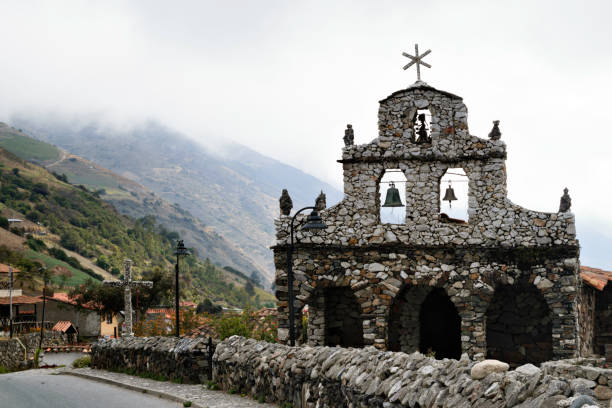
Stone Churh, San Rafael de Mucuchies, Merida state, Venezuela. Hand made small church which is an important landmark. Mucuchies is the main town in El Paramo Andino, in Merida state, Venezuela. Located about 2400 meters above sea level. It is a farmer´s town with large plantations of potatoes, carrots and garlic. It is characterized by a cold climate, colorful mountains and, due to its agricultural activity, stone boundaries, small waterfalls, wild flowers and frailejons, shows incredible and beautiful landscapes.
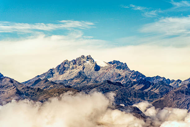
Wide angle aerial view of Bolivar and Humboldt mountain peaks at Merida state in Cordillera de los Andes. Venezuela
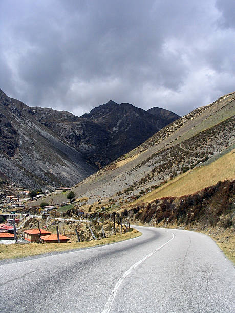
"On route to the highest car-pass in Venezuela, Pico del Aguila (4200m / 12.600ft)"
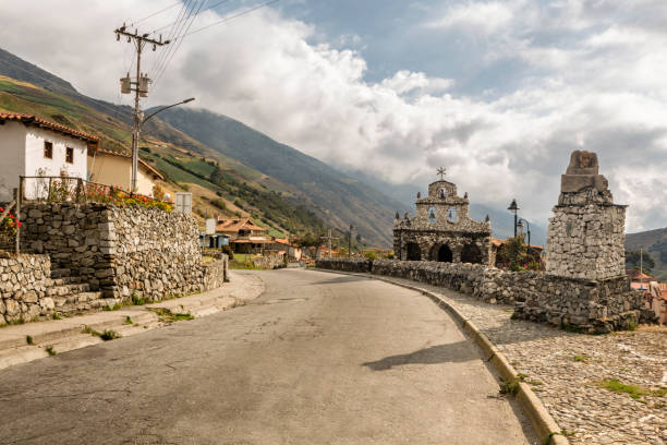
Stone Churh, San Rafael de Mucuchies, Merida state, Venezuela. Hand made small church which is an important landmark. Mucuchies is the main town in El Paramo Andino, in Merida state, Venezuela. Located about 2400 meters above sea level. It is a farmer´s town with large plantations of potatoes, carrots and garlic. It is characterized by a cold climate, colorful mountains and, due to its agricultural activity, stone boundaries, small waterfalls, wild flowers and frailejons, shows incredible and beautiful landscapes.
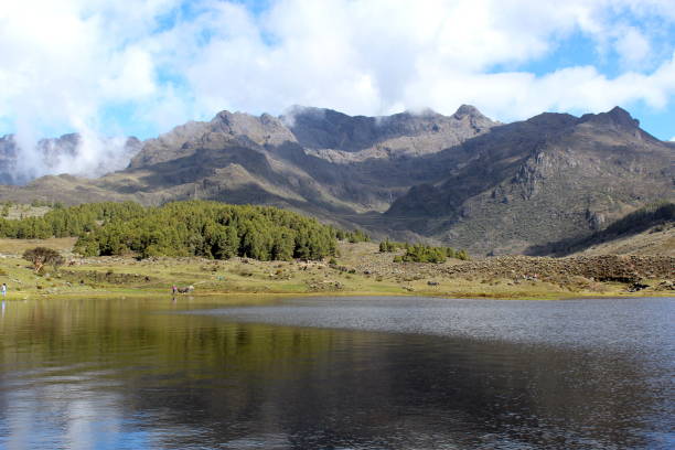
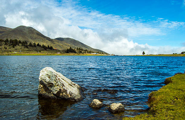
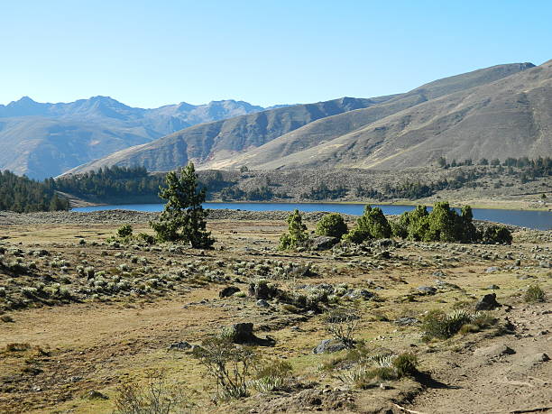
Merida, Venezuela, AUG 11: Mucubaji Lagoon is one of the biggest lagoon in the region, located in Sierra Nevada National Park. Picture taken on Aug 11, 2014.
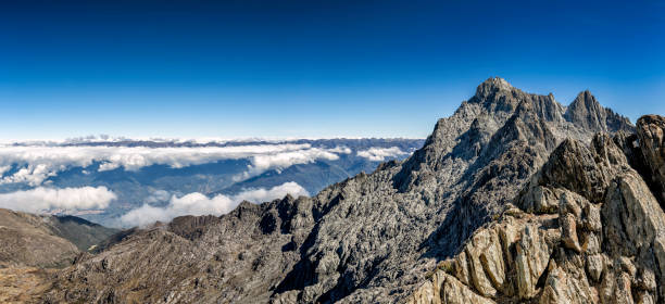
Panoramic view of Pico Bolivar or Bolivar pic of 4978 mts and Sierra de La Culata at the background. Below Merida City Valley. Imake taken from Pico Espejo station, the highest in the world and the last of 5 stations in the Mucumbari cable car system. Sierra Nevada National Park. Merida State, Venezuela.
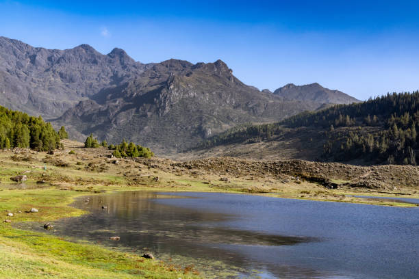
The Mucubají lagoon is located in the Sierra Nevada Park, in the Mérida state of Venezuela. It is one of the largest in the region

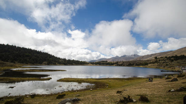
Panoramic landscape of Mucubaji lagoon at sunrise in Merida state. Mucubaji lagoon ios located at 3650 mts above sea level and it is a very turistica place in the Paramo Andino of Venezuela.

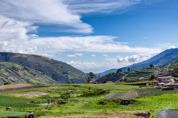
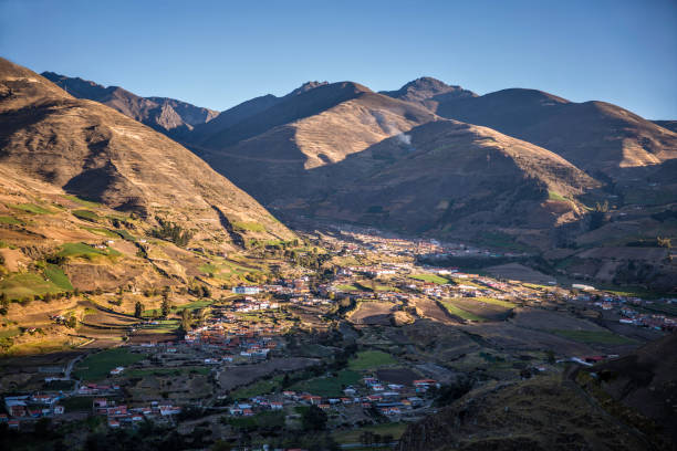
Escagüey is a beautiful village in Mérida state, Venezuela. It has an elevation of 2,206 metres over see level. Escagüey is situated nearby to Mesa Libre, and northeast of Cacute.
Location : Merida Venezuela ,Mububaji Lake
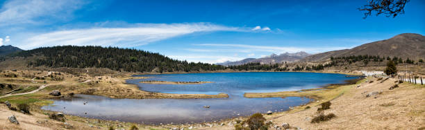
Panoramic landscape of Mucubaji lagoon with Frailejons, Merida state, Venezuela. Mucubaji lagoon ios located at 3650 mts above sea level and it is a very turistica place in the Paramo Andino. Frailejon is an endemic plant that grows above 2800 over sea level and is found all over Cordillera de Los Andes in South America.
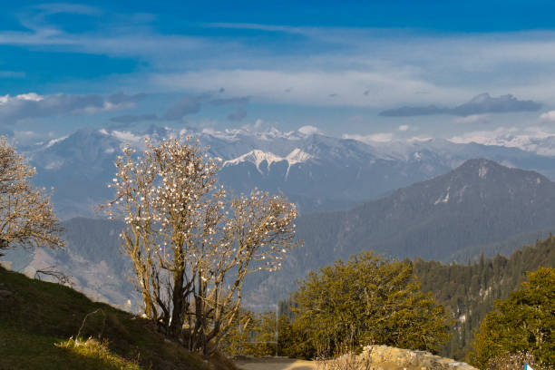
Annual trekking in the tropical Andes - Early morning at 4500 mts altitude - Mérida - Venezuela - December 2013
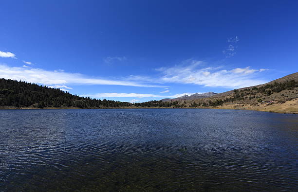
Kettle Mucubají a glacial lake located in Sierra Nevada National Park, in the Mérida State of Venezuela. The lake is 3625 metres above sea level
Mucubaji's Lagoon in Sierra Nevada National Park, in Merida State, Venezuela. Date: Jan-2014
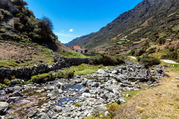
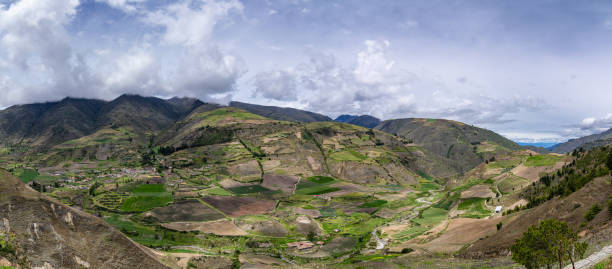
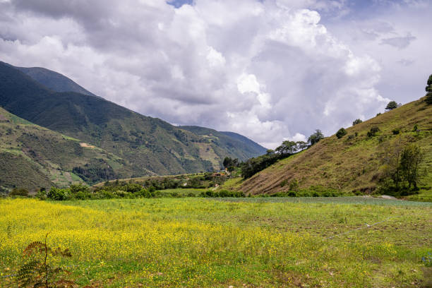
Landscape of Gavidia river. Gavidia is a agriculture village in Mérida state, Venezuela located about 2500 meters above sea level. The road to reach it crosses a spectacular canyon and remains parallel to the Gavidia River. It is a farmers' village with large plantations of potatoes, carrots and garlic. It is characterized by a cold climate, colorful mountains and, due to its agricultural activity, stone boundaries, small waterfalls, wild flowers and frailejons, shows incredible and beautiful landscapes.
Panoramic landscape of Gavidia valley with Frailejons. Merida state, Venezuela. Frailejon is an endemic plant that grows above 2800 over sea level and is found all over Cordillera de Los Andes in South America.
Panoramic landscape Cordillera de Los Andes seen from Mucubaji lagoon, Merida state, Venezuela Mucubaji lagoon is located at 3650 mts above sea level and it is a very turistica place in the Paramo Andino. Frailejon is an endemic plant that grows above 2800 over sea level and is found all over Cordillera de Los Andes in South America.
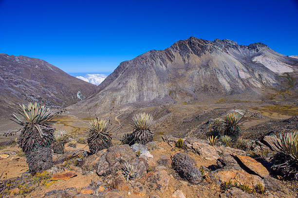
Panoramic landscape of moutain range with Frailejons seen from Pico El Aguila. Merida, Venezuela. Frailejon is an endemic plant that grows above 2800 over sea level and is found all over Cordillera de Los Andes in South America.
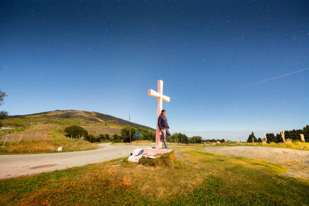
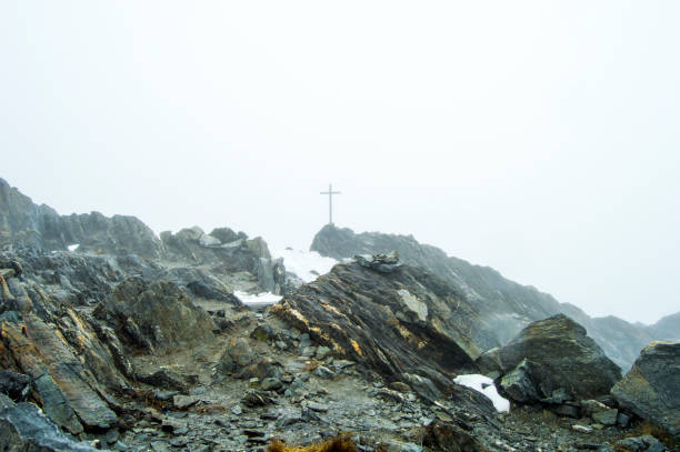
Young man poses leaning on a cross at La Mision Point of the Andes Region in Merida State, Venezuela above 3,200 masl. This is a long exposure shot de thirty seconds where there is, of course, some blurred movement of the subject but the illumination achieved with the long exposure converting the scene as a late afternoon landscape image made it special.
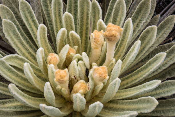
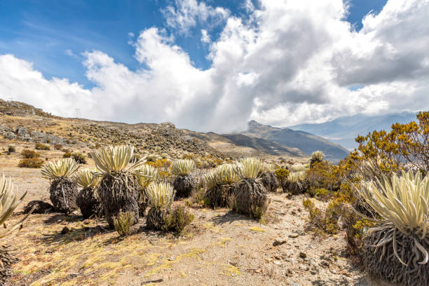
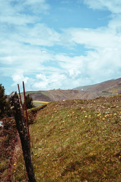
Frailejon is an endemic plant that grows above 2800 over sea level and is found all over Cordillera de Los Andes in South America. Also known as mule´s ears
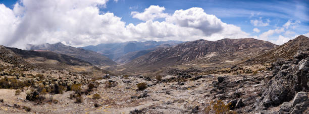
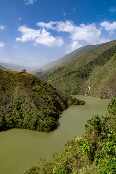
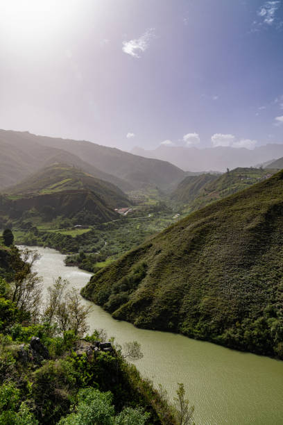
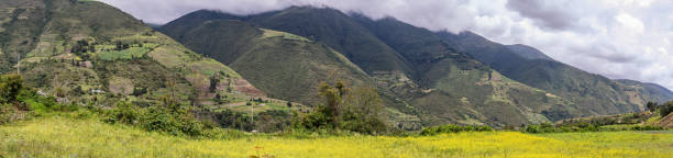
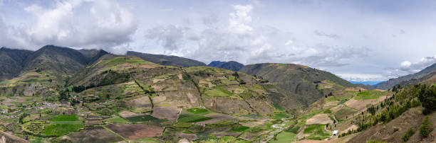
Aerial panoramic view of the andean mountains in Merida state, Venezuela. Merida is the most mountainous in the country. It is crossed by three mountain ranges of the Cordillera de Los Andes, which are La Sierra Nevada de Mérida
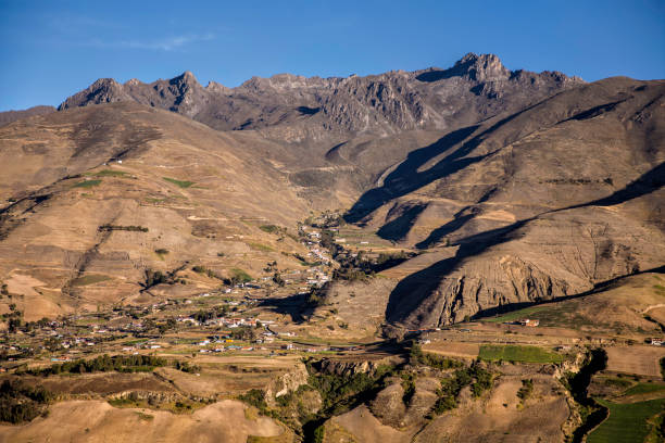
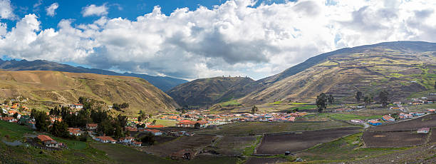
Panoramic landscape of Mucuchies valley early in the morning. Merida state, Venezuela.
Panoramic landscape of Mucuchies valley early in the morning. Merida state, Venezuela.

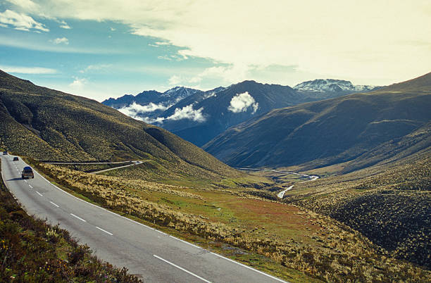
Road through the paramos of Sierra Nevada National Park, Merida State, Venezuela
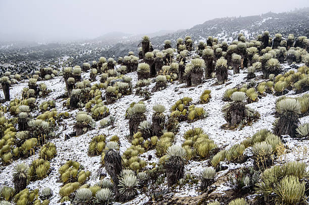
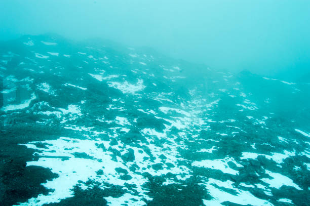
Snow valley with frailejones from La Culata National Park in Merida, Venezuela.
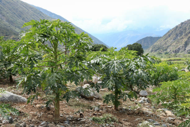
View of papaya trees growing in valley against mountain range, Merida, Venezuela.
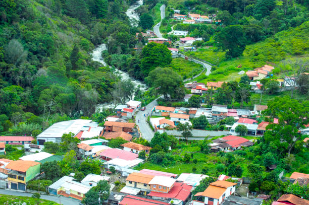
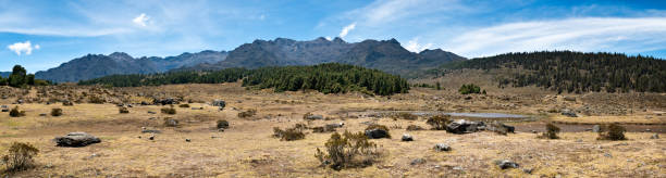
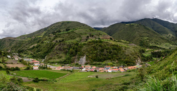
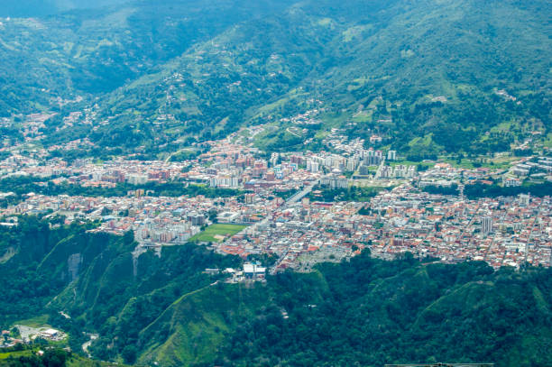
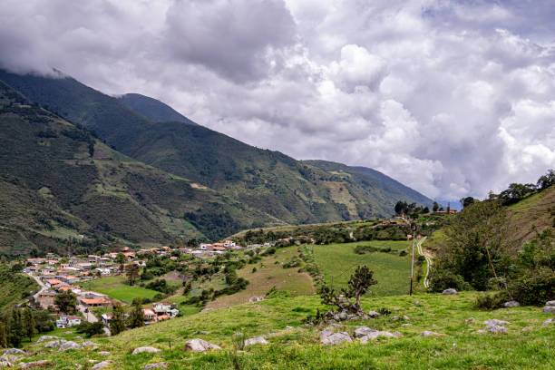
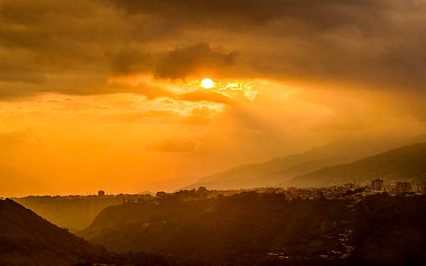
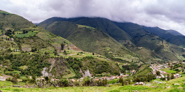
Scenic panorama of the mountains and small village in the Andes mountains, cloudy blue sky. Merida, Venezuela
Aerial panoramic view of the andean mountains in Merida state, Venezuela. Merida is the most mountainous in the country. It is crossed by three mountain ranges of the Cordillera de Los Andes, which are La Sierra Nevada de Mérida
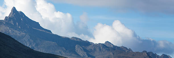
Panorama of a mountain peak around Merida state against a blue and cloudy sky. Venezuela
Landscape of Mucubaji lagoon at sunrise in Merida state. Mucubaji lagoon ios located at 3650 mts above sea level and it is a very turistica place in the Paramo Andino of Venezuela.
natural landscape photography
natural landscape photography
natural landscape photography
natural landscape photography

Snow valley with frailejones and a snowman from La Culata National Park in Merida, Venezuela.
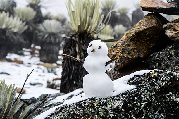
Snow valley with frailejones and a snowman from La Culata National Park in Merida, Venezuela.

Snow valley with frailejones and a snowman from La Culata National Park in Merida, Venezuela.
Gavidia river. Gavidia is a agriculture village in Mérida state, Venezuela located about 2500 meters above sea level. The road to reach it crosses a spectacular canyon and remains parallel to the Gavidia River. It is a farmers' village with large plantations of potatoes, carrots and garlic. It is characterized by a cold climate, colorful mountains and, due to its agricultural activity, stone boundaries, small waterfalls, wild flowers and frailejons, shows incredible and beautiful landscapes.
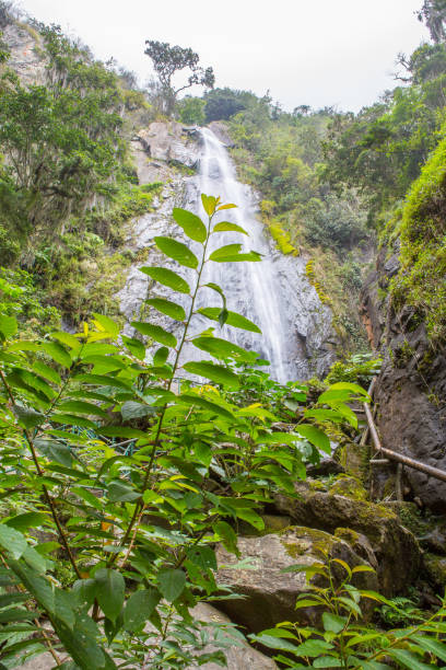
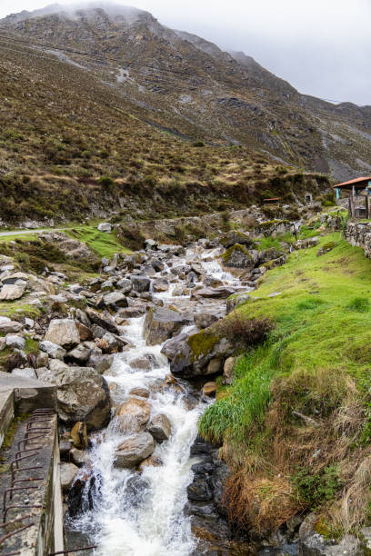
Waterfall in Bailadores, Merida State, Venezuela. Its name is La Cascada de la India Caru in Jose Antonio Paez Park. This is Venezuelan Andes.
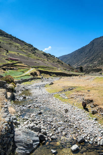
Landscape of Gavidia river. Gavidia is a agriculture village in Mérida state, Venezuela located about 2500 meters above sea level. The road to reach it crosses a spectacular canyon and remains parallel to the Gavidia River. It is a farmers' village with large plantations of potatoes, carrots and garlic. It is characterized by a cold climate, colorful mountains and, due to its agricultural activity, stone boundaries, small waterfalls, wild flowers and frailejons, shows incredible and beautiful landscapes.
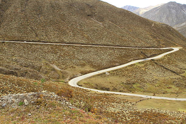
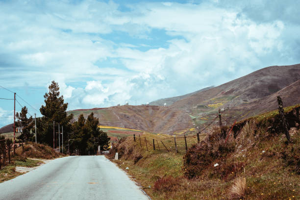
This curved road located at more than 3,200 m.o.s.l. takes people to the Venezuelan paramo in Merida State. It is surrounded by many frailejon or Espeletia plants which is endemic to the zone
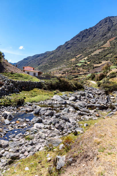
Landscape of Gavidia river. Gavidia is a agriculture village in Mérida state, Venezuela located about 2500 meters above sea level. The road to reach it crosses a spectacular canyon and remains parallel to the Gavidia River. It is a farmers' village with large plantations of potatoes, carrots and garlic. It is characterized by a cold climate, colorful mountains and, due to its agricultural activity, stone boundaries, small waterfalls, wild flowers and frailejons, shows incredible and beautiful landscapes.
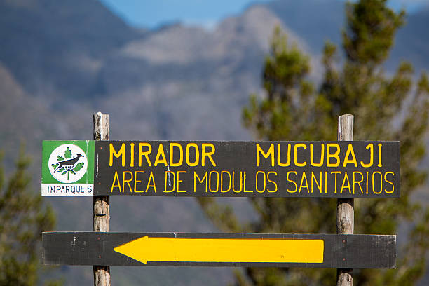
Merida, Venezuela - April 30, 2015: Wooden road sign showing the direction toward the Mirador Mucubaji with the forest and mountains in the background. Venezuela 2015.
location : venezuela mérida los andes
Escagüey is a beautiful village in Mérida state, Venezuela. It has an elevation of 2,206 metres over see level. Escagüey is situated nearby to Mesa Libre, and northeast of Cacute.
Escagüey is a beautiful village in Mérida state, Venezuela. It has an elevation of 2,206 metres over see level. Escagüey is situated nearby to Mesa Libre, and northeast of Cacute.
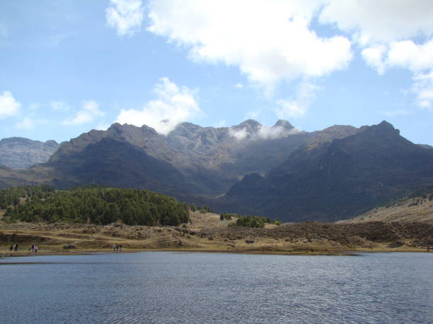
Merida, Venezuela, FEB 21: Mucubaji Lagoon is one of the biggest lagoon in the region, located in Sierra Nevada National Park. Picture taken on FEB 21, 2010.
Escagüey is a beautiful village in Mérida state, Venezuela. It has an elevation of 2,206 metres over see level. Escagüey is situated nearby to Mesa Libre, and northeast of Cacute.
Escagüey is a beautiful village in Mérida state, Venezuela. It has an elevation of 2,206 metres over see level. Escagüey is situated nearby to Mesa Libre, and northeast of Cacute.
Escagüey is a beautiful village in Mérida state, Venezuela. It has an elevation of 2,206 metres over see level. Escagüey is situated nearby to Mesa Libre, and northeast of Cacute.